Property Description:
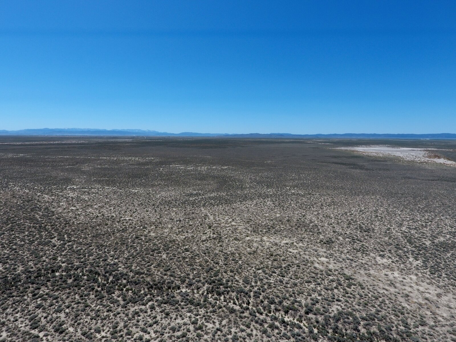
Waiting For You! An Affordable and Beautiful 40 Acre Parcel For Your Off-Grid and RV Trip Living. Spectacular Mountain Views, and Clear Starry Night Utah Countryside will Melt Away Your Daily Life Stresses. Close to Everything you want from the World but Far Enough Away to Also Forget about The World!
This 40AC lot is only about 3.3 miles Southeast of Beryl and 28 miles north of the city of Enterprise, Utah, which contains schools, a post office, gas stations, restaurants, and all of the other amenities you could need. Cedar City, a thriving town of 30,000, is less than an hour away. It includes multiple hospitals and a regional airport. St. George, UT to the South with its BIG City feel WITH EVERYTHING YOU’LL NEED is just over an hour’s drive. The Nevada Border is 30 minutes away and the Arizona Border is just past St. George. LAS VEGAS is a less than 3 hours away on the Interstate 15
For Local Attractions, about 50 minutes from the Property is Snow Canyon State Park – Awesome to Hike, Bike, and Camp. It includes Paved and Unpaved trails, Dunes, Steep rocks, and so much more. Reservoirs are also just 20-30 minutes away, making it the Perfect Getaway for Boating, Fishing, and Hiking. The World-Famous Zion National Park – 1 hour 40 minutes, Kanarraville Falls – Under an Hour’s Drive and if Skiing is your passion, 5 Star Brian Head Ski Resort is a mere 90 minutes away.
This property is zoned Agricultural, making it Very Flexible for Various Land Uses. Maybe Build your Rural Ranch here Someday! To give you a Perspective, 40 Acres is about the Size of 40 football fields.
Pricing:
Discounted 40 AC Real Deal LOT Cash Price: $21,865.00.
Available Owner Financing – $ 999 down payment, $347/month for 84 months. We can work with your budget but around mainly around these numbers.
Please Note that a One Time Non Refundable Documentation Fee of $250 is on top for either Cash or Terms Sales. Monthly Terms Sales exclude a $10 monthly Property Tax Payable plus a $20 monthly Transaction fee.
For only $999 Down Payment, Isn’t It Time to OWN Some Beautiful AND AFFORDABLE Utah Land?
Property Information:
County: Iron County, Utah
APN: E-1523-0013-0000 and E-1523-0014-0000
GPS Center Coordinates: 37.8691, -113.7157
GPS Coordinates (4 Corners):
37.8673, -113.7180
37.8673, -113.7134
37.8709, -113.7180
37.8709, -113.7134
Acreage: 40 Acres
Attributes: Mountain views, Access, Acreage, Affordability
Zoning: Agricultural
Electricity: Solar Recommended and widely used
Water: Would be by well. You will likely need to drill a well in order to access water. All Buyers need to purchase Water Rights in Iron County. See below for Cedar City Water Appropriation telephone number and to get more Details
Sewer: Would be by septic system
Road Access: 20 foot wide Easement running along the Entire North Edge of the Property (Runs with the Land) starting from the Railway Maintenance Road to the West.
Deed Type: Special Warranty Deed
Annual Taxes: Approx. $100 to $120
Tax Status: Current
POA/HOA: N/A
County Information:
County: Iron County
State: UTAH
Assessor’s Office Phone Number (435) 477-8310
Assessor’s Website: www.ironcounty.net/government/departments/assessor/about
Treasurer’s Website https://eagleweb.ironcounty.net/treasurer/web/
Cedar City Water Appropriation Telephone Number – (435) 586 4231
Directions:
From St. George, UTAH
Take Interstate 15 to St. George, UTAH. Turn North on US 18 N From St. George and drive to Beryl Junction bypassing Enterprise, UTAH. At Beryl Junction, head straight north on N Beryl Highway 12.9 miles. Then turn Left (West) onto the Dirt Road at the town of Beryl which is a continuation of N Beryl Highway (becomes part of N End of 1600 W) for 2.1 miles. At this point, you will be on the Maintenance Road for the Railway Track which will be on your right side. Follow the GPS coordinates to find the exact location.
From Cedar City, UTAH
Take Interstate 15 to Cedar City, UTAH. From Cedar City, head west on UT-56 W towards Beryl Junction for about 36 miles. At Beryl Junction, head straight north on N Beryl Highway 12.9 miles. Then turn Left (West) onto the Dirt Road at the town of Beryl which is a continuation of N Beryl Highway (becomes part of N End of 1600 W) for 2.1 miles. At this point, you will be on the Maintenance Road for the Railway Track which will be on your right side. Follow the GPS coordinates to find the exact location.
Google Map Link to Center Coordinates: https://goo.gl/maps/fCUBWnqS6amujU1i6
Important Notes:
– All of the information we have about this Property is contained here.
– We ask that buyers do their own Due Diligence
– You can visit any of our properties at any Time. GPS Co-ordinates and Driving Directions Given
– Please call the Applicable County offices for any Specific Questions about the Property
Submit Your Documentation Fee
Please submit your documentation fee using an applicable payment method below. Once payment is submitted, please check the box and submit the form to give your consent to be contacted.
Disclaimer: Buyer is responsible for verifying all information with the County as to what can and can’t be done with the land. Buyer will need to work with the County to obtain the proper permits if needed. Buyer will also need to confirm the availability of any utilities needed or serviced on the property. Seller makes no warranties or representations about the land, its condition, or what can be built on the lot parcel.


